Brief annotation
About the document
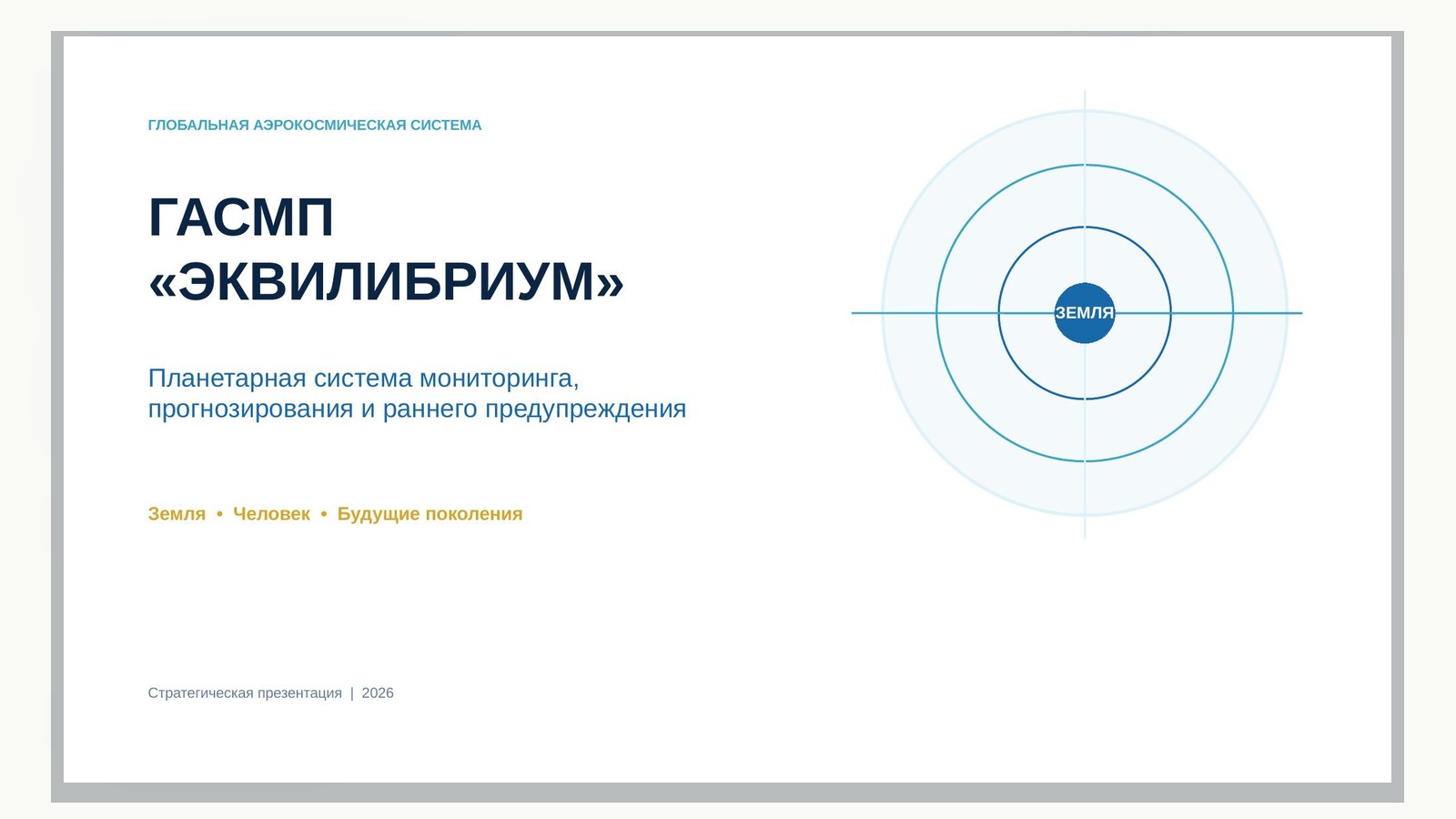
Planetary system for monitoring, forecasting and early warning
Not just another data source, but a connecting architecture of planetary responsibility
GASMP_EQUILIBRIUM_Presentation.pptx
Downloading the document...
and Early Warning
EARTH • MAN • FUTURE GENERATIONS
Strategic concept
Version 1.0
EQUILIBRIUM — SFERA — ECO-PPA — SPECZASHCHITA
Passport Concept
| Parameter | Contents |
|---|---|
| Name | Global Aerospace Monitoring and Forecasting System "EQUILIBRIUM" |
| Brief designation | GASMP “EQUILIBRIUM” |
| Purpose | Early detection of planetary, natural, man-made, biological and space threats; forecasting their development; coordination of warning and response. |
| Scale | Local → municipal → regional → national → transboundary → planetary |
| Basic principle | See you sooner. To be precise. Warn in time. Act together. Restoring balance. |
| Target Users | States, international organizations, research centres, response services, companies, territories and citizens. |
| Document status | Conceptual basis. Technical, legal and financial parameters are subject to verification during the pre-project stage. |
EQUILIBRIUM is a planetary early warning system combining aerospace observation, artificial intelligence, scientific forecasting, and international cooperation to protect the Earth, humans, and future generations.
Executive summary
The world has thousands of satellites, sensors, scientific models and departmental platforms, but these resources remain divided by country, industry and type of threat. SASMP "EQUILIBRIUM" forms a supersystem of compatibility: it does not replace national systems, but connects them through unified protocols of trust, validation and response.
The central result is a continuous digital circuit "observation" → recognition → forecast → Warning → Resource mobilization → Action → Recovery → confirmed result." The system converts disparate data into verifiable scenarios and specific management decisions.
| Strategic effect | Practical result |
|---|---|
| Transition from reaction to prevention | Reducing the time of threat detection and cost of consequences. |
| A unified picture of the planet | Compatible digital twin of Earth and near-Earth space. |
| Scientific evidence | Traceability of data, models, forecasts and solutions. |
| Sovereign cooperation | Exchange of necessary indicators without loss of control over the source data. |
| Performance | Automatic linking of forecast with responsible, resources and action plan. |
1. Reasons for creation
Modern threats develop faster than administrative cycles and are rarely confined to a single industry or border. Climate anomalies affect water, crop, migration and energy; space weather - on communication, navigation and energy networks; man-made accidents - on ecosystems and public health.
- Fragmentation of observations and incompatibility of departmental data.
- Lack of connection between scientific forecasting and management action.
- Later detection of weak signals and cascade risks.
- Lack of a unified system of trust in sources, models and warnings.
- The gap between threat assessment, resource mobilization and outcome control.
STRATEGIC TRANSITION From incident cataloguing to probability management; from individual sensors to holistic observation; from departmental response to intersystem cooperation.
2. Mission, purpose and principles
Mission. Preserving planetary balance through timely knowledge, collective intelligence, and concerted action.
Purpose. Build a trusted global infrastructure capable of continuously assessing the state of the Earth and near-Earth space, warning of evolving threats and launching measurable preventive measures.
| Principle | Contents |
|---|---|
| Prevention | Priority of prevention over elimination of consequences. |
| Integrity | Joint analysis of nature, technosphere, man and space. |
| Science | Verifiable data, models and uncertainty assessment. |
| Sovereignty | Owner control over source data and access modes. |
| Federality | Connectivity without the mandatory centralization of all arrays. |
| Responsibility | Each signal has an owner, time, action and result. |
| Ethics | Protection of human rights, prevention of discrimination and abuse. |
3. Monitoring objects
| Contour | Key objects and phenomena |
|---|---|
| Atmosphere and climate | Temperature, precipitation, aerosols, greenhouse gases, cyclones, droughts, fire hazard. |
| Hydrosphere | Oceans, rivers, reservoirs, glaciers, floods, water quality and availability. |
| Lithosphere | Earthquakes, volcanoes, landslides, karst, subsidence, deformation of structures. |
| Biosphere | Forests, soils, biodiversity, state of biocenoses, plant and animal diseases. |
| Technosphere | Energy, industry, transport, dams, pipelines, critical infrastructure. |
| Humanitarian Outline | Epidemics, food and water risks, migration, access to assistance. |
| Near-Earth space | Solar activity, radiation, space debris, dangerous encounters, asteroids. |
4. Multilevel surveillance system
| Level | Funds | Purpose |
|---|---|---|
| Space | ERS satellites, weather apparatus, optical and radar systems | Global overview and long-term series. |
| Stratospheric | Aerostats, high-altitude UAVs, pseudo-satellites | Prolonged regional surveillance. |
| Aviation | Aircraft laboratories, UAVs, helicopters | Detailed and operational intelligence. |
| Marine | Buoys, vessels, underwater stations and autonomous vehicles | Oceans, seas, shelf and underwater environment. |
| Ground | Radars, stations, seismic networks, IoT sensors | Continuous Local Dimension. |
| Biosphere | Biocenose monitoring points | Observing ecosystems as living complexes. |
| Social | Registers, appeals, statistics, dispatching systems | Assessing vulnerability and need for assistance. |
5. Intelligent Core EQUILIBRIUM
The intellectual core combines space-time data, digital twins, physical models, machine learning, and expert knowledge. It does not replace a specialist: recommendations are accompanied by sources, an assessment of confidence and an explanation of factors.
- Collection and normalization of data flows.
- Detection of anomalies and weak signals.
- Recognition of cause-effect and cascade relationships.
- Simulation of scenarios and digital experiments.
- Estimation of probability, scale, horizon and expected damage.
- Formation of warnings and sets of preventive measures.
- Feedback on the actual outcome and further training of models.
FORMULA FORECAST Event + Probability + horizon + Territory + Impact scale + Confidential interval + Data sources + Recommended Action.
6. The Digital Twin of Earth
The digital twin of the Earth is a dynamic model of the state of natural, infrastructure and social systems. It is built as a federation of national and sectoral twins, linked by a single metadata and temporal-spatial binding.
| Layer | Contents |
|---|---|
| Geophysical | Relief, geology, seismics, hydrology, atmosphere. |
| Environmental | Biocenoses, ecosystem services, pollution, natural capital. |
| Infrastructure | Energy, transport, communications, industry, social facilities. |
| Resource | Water, food, raw materials, reserves, response capacity. |
| Scenario | History of events, forecast branches, consequences of decisions. |
| Management | Responsible, regulations, resources, execution status. |
7. Horizons and forecasting scenarios
| Horizon | Period | Key decisions |
|---|---|---|
| Operational | Minutes — 72 hours | Alert, evacuation, localization, protection of infrastructure. |
| Short-term | 3–30 days | Redistribution of resources, modes of readiness, logistics. |
| Medium-term | 1–12 months | Seed solutions, water and energy balance, prevention. |
| Strategic | 1–10 years | Infrastructure investments, adaptation of territories, standards. |
| Civilizing | 10–100 years | Scenarios of settlement, climate, resources, and planetary sustainability. |
For each significant risk, at least five branches are formed: inertial, unfavorable, critical, manageable and targeted recovery. Branches are recalculated when new data is received.
8. Early Warning Contour
| Stage | Result | Responsible contour |
|---|---|---|
| 1. Monitoring | Measurement and message streams | Data operators and sensor networks. |
| 2. Identification | Anomaly or weak signal | AI-core and analytical centers. |
| 3. Verification | Confirmed Assessment and Uncertainty | Scientific and accredited centers. |
| 4. Warning | Address message with priority | Situation centers. |
| 5. Decision | Selected scenario and action plan | Authorized body. |
| 6. Implementation | Mobilized forces and resources | ECO-PPA and SPECZASHCHITA. |
| 7. Monitoring | Measurable Impact and Lessons | EQUILIBRIUM and independent validation. |
9. Threat levels and action protocols
| Level | Characteristic | Mode |
|---|---|---|
| Green | Background; deviations within acceptable limits. | Monitoring and updating of baselines. |
| Yellow | Persistent weak signal or increasing uncertainty. | Enhanced monitoring and expert verification. |
| Orange | High probability of a significant event. | Training of forces, reserves and targeted warning. |
| Red | The event is inevitable or is already developing. | Immediate response and inter-agency coordination. |
| Purple | Cross-border or planetary cascade risk. | International Protocol of Joint Action. |
The threshold of transition between levels is set separately for each type of threat and territory. The automated system can initiate verification and distribute a technical signal, but decisions affecting citizens’ rights and sovereign powers are made by authorized people.
10. Management system
| Organ | Function |
|---|---|
| International Supervisory Board | Principles, trust, balance of interests and international legitimacy. |
| The Scientific and Forecasting Council | Methodologies, models, independent expertise and ethics of science. |
| Global Situation Centre | Planetary picture, cross-border risks and coordination. |
| National nodes | Sovereign management of data, warnings and responses. |
| Regional centres | Local detail and interaction of services. |
| Validation Centers | Confirmation of data quality, models, forecasts and results. |
| Infrastructure operators | Operation of satellites, UAVs, communication networks and sensors. |
11. Data Sovereignty and Trust
The architecture is built on the principle of federative analytics: sensitive arrays can remain with the owner, and the allowed indicators, models, proof of origin and warnings are transferred to the general outline.
| Access Class | Example | Management |
|---|---|---|
| Open | Public maps, basic indexes, educational data. | Open licenses and machine-readable interfaces. |
| Professional | Detailed scientific and industry sets. | Registration, licensing, use agreements. |
| Interagency | Operational data for management. | Role access, logging, secure channels. |
| Sovereign | National arrays and models of critical objects. | Storage and calculations in the national contour. |
| of particular importance | Data whose disclosure poses a security risk. | Isolated contours and special regulations. |
- Unchangeable log of origin and transformation of data.
- Cryptographic identification of sources and participants.
- Quality assessment: completeness, timeliness, accuracy, consistency.
- Versioning of models and reproducibility of calculations.
- Independent audit of algorithms and a mechanism for appealing decisions.
12. Scientific Validation and Evidence
The forecast is considered managerially suitable only after passing the established level of verification. The depth of validation depends on the urgency and potential damage: with an immediate threat, an accelerated mode is allowed with a mandatory subsequent audit.
| Object of verification | Criteria |
|---|---|
| Data | Origin, calibration, spatio-temporal accuracy, omissions. |
| Model | Purpose, scope, quality of training, sustainability. |
| Forecast | Probability, uncertainty interval, alternatives, retrospective accuracy. |
| Recommendation | Proportionality, feasibility, side effects, responsible person. |
| Result | Actual effect, cost, preventable damage, lessons. |
13. Ecosystem Integration EQUILIBRIUM
| Element | Role in GASMP |
|---|---|
| EQUILIBRIUM | Surveillance, digital twin, forecasting, control and balance. |
| SFERA | A common space of initiatives, communications and public participation. |
| ECO-PPA | Mobilization of public and private resources for confirmed tasks. |
| SPECZASHCHITA | Cooperative organization of project consortia and practical implementation. |
| Biocenose points | Ground-based network of holistic observations of local ecosystems. |
| ESG-IR | Impact measurement, evidence and sustainability rating. |
| EUT | Unified protocols, registries, technological compatibility and human balance. |
THROUGH THE PROCESS Signal → Verified threat → Initiative → Expertise → Co-operation → resource support → Pilot → Confirmed result → Scaling.
14. Products & Services
- Planetary map of risks and early signals.
- Digital twin of Earth and near-Earth space.
- Passports of stability of states, regions, cities and objects.
- Forecasts of crop, water, fires, floods, epidemics and infrastructure risks.
- Targeted warning service for the population and organizations.
- Register of warnings, decisions, executors and confirmed results.
- Marketplace of data, models, sensors and analytical services.
- Insurance, investment and compensation products based on verified data.
- International Bank for Reconstruction Scenarios and Best Practices
15. Financial and economic model
GASM creates a public good, but requires a sustainable mixed funding model. Basic infrastructure is provided by states and international programs; application services - subscriptions, contracts, insurance and investment mechanisms; scientific and humanitarian directions - grants and trust funds.
| Source | Purpose |
|---|---|
| Government programs | National infrastructure, security, research and preparedness. |
| International funds | Cross-border contours, common standards, assistance to vulnerable territories. |
| PPPs and concession models | Satellite, sensor, computing and telecommunications infrastructure. |
| Corporate contracts | Monitoring of facilities, supply chains and industry risks. |
| Insurance mechanisms | Parametric products, damage reduction and prevention financing. |
| ECO-PPA | Attracting resources to confirmed environmental and infrastructure results. |
Part of the confirmed prevented damage can be directed to the development of infrastructure for the prevention and restoration of natural capital - only after legal and financial verification of the methodology.
16. International cooperation
The system should develop as an open cooperation architecture compatible with existing national and international mechanisms. The partnership is built around specific public goods: disaster prevention, climate monitoring, ocean protection, space security, and the sustainability of critical infrastructure.
- Intergovernmental Agreement on Principles and Regimes of Exchange.
- General catalog of data, models and computing services.
- Joint cross-border training and exercises.
- Mutual recognition of validation centers and methodologies.
- Mechanism of emergency provision of images, communication and computing power.
- Training program and open scientific cooperation.
17. Ethical and legal safeguards
| Risk | Warranty |
|---|---|
| Mass surveillance of people | Minimization of personal data, legitimate purpose, proportionality and supervision. |
| Algorithmic discrimination | Testing biases, explicability, and the right to review by a person. |
| False alarms | Threshold models, multi-source verification and uncertainty indication. |
| Hiding dangerous information | Mandatory protocols for disclosure of cross-border threats and audit. |
| Military or Unfair Use | Separation of civilian contours, access control and international guarantees. |
| Dependence on one operator | Open standards, portability and redundancy of critical functions. |
18. Cybersecurity and continuity
- A zero-trust architecture with minimal powers.
- Geographically distributed reservation of centers and communication channels.
- Protection of the supply chain of software and hardware.
- Detection of sensor data substitution and attacks on artificial intelligence models.
- Manual and autonomous backup modes for critical warnings.
- Regular cyber exercises, recovery verification and independent audit.
19. Key performance indicators
| Group | Examples of indicators |
|---|---|
| Coverage | The proportion of land, population, ecosystems and critical objects under observation. |
| Timeliness | Average time from signal to confirmation, warning and decision. |
| Quality | Predict accuracy, false alarm rate, probability calibration. |
| Implementation | Proportion of warnings with a designated responsible and closed action plan. |
| Effect | Prevented damage, saved lives, area of restored ecosystems. |
| Trust | The proportion of proven sources, replicable models and successfully passed audits. |
| Resilience | Availability of services, recovery time, reservation of critical functions. |
20. Road map of creation
| Stage | Timeframe | Result |
|---|---|---|
| 0. Pre-project | 0–6 months | Consortium, legal model, architecture, data catalog, pilot selection. |
| 1. Pilot region | 6–18 months | Integration of satellites, UAVs, biocenose points and situational center; 3–5 threat scenarios. |
| 2. National outline | 18–36 months | A federal network of departments, industries, research centers and operators. |
| 3. Outline of partners | 3–5 years | Cross-border polygons, mutual validation, common exercises and services. |
| 4. Planetary system | 5–10 years | Global digital twin, round-the-clock situational contour and scaling. |
Priorities of the first 100 days
- Approve the initiating council and project office.
- Form a passport of the pilot territory and a list of threats.
- Take inventory of available data, sensors, satellite services and models.
- Identify five measurable early warning scenarios.
- Develop protocols for exchange, validation, classification and response.
- Prepare a feasibility study and a financial model of the pilot.
- Launch a demonstration situation screen and the first interdepartmental exercise.
21. Recommended Pilot
It is advisable to build a pilot around one geographically integral territory, where natural, infrastructural and social risks are simultaneously presented. The minimum contour should include: flood or fire; water and air quality; critical infrastructure stability; biocenose monitoring; and population targeted warning.
| Readiness parameter | Launch criterion |
|---|---|
| Management | The customer, operator, scientific supervisor and response services are determined. |
| Data | At least three independent source classes for key scenarios. |
| Infrastructure | Secure integration platform and backup alert channel. |
| Methodology | Fixed baselines, thresholds, quality metrics and validation protocol. |
| Implementation | Training was conducted, resources and deadlines were assigned. |
| Public trust | The goals, restrictions, data protection rules and feedback channel have been published. |
22. Solutions needed to start
- To recognize GASMP "EQUILIBRIUM" as a priority initiative of planetary security and sustainable development.
- Establish an inter-agency and international working group.
- Identify the pilot area and five priority scenarios.
- Approve the principles of sovereignty, ethics, validation and data exchange.
- Forming a project consortium EQUILIBRIUM — SFERA — ECO-PPA — SPECZASHCHITA.
- Prepare the technical specification, feasibility study, financial and legal model.
- Run the demonstration circuit within 12 months after pre-project approval.
The final positioning of the EQUILIBRIUM system is not yet another observation system, but a connecting architecture of planetary responsibility: it turns data into knowledge, knowledge into a timely solution, and decision into a confirmed result.
Conclusion
Humanity already possesses most of the necessary means: aerospace platforms, sensor networks, computing power, scientific models and response institutes. The main deficit is not a separate technology, but a trusted connection between observation, prognosis and action.
GASMP "EQUILIBRIUM" offers such connectivity. Its creation forms a new culture of security: threats are identified before the transition to disaster, resources are mobilized on the basis of evidence, and the result is assessed on the basis of saved lives, the stability of territories and restored balance.
SEE BEFORE • UNDERSTAND EXACTLY • ACTING COMMUNICATIONS
Source materials
Originals and versions of the document
- GASMP_EQUILIBRIUM_Strategicheskaya_kontseptsiya.docxDOCX · main document
- GASMP_EQUILIBRIUM_Presentation.pptxPPTX · related version
Other editions in web format
Each version is disclosed separately; the sequence of the source document is saved.
GASMP “EQUILIBRIUM”GASMP_EQUILIBRIUM_Presentation.pptx · Web Text+
Planetary system for monitoring, forecasting and early warning
LAND
Land • Man • Future generations
Strategic presentation | 2026
The system turns surveillance into action
MAIN IDEA
Not just another data source, but a connecting architecture of planetary responsibility
OBSERVATION
UNDERSTANDING
TREASURE
ACTION
RESULT
Data from Earth and Space
AI + scientific models
Risk, place, time
Resources and implementers
Restored Balance
See before • Understand more precisely • Warn in time • Act together
GASMP “EQUILIBRIUM”
Threats are linked - surveillance systems are fragmented
WHY NOW
Energy
Climate
CASCADE
RISK
Infrastructure
Water
Health
One anomaly triggers effects in several industries and territories.
GASMP “EQUILIBRIUM”
Seven levels create a single picture of the planet
ARCHITECTURE OF OBSERVATION
Kosmos
Remote sensing satellites, weather apparatus, orbital stations
STRATOSPHERE
Aerostats, high-altitude UAVs, pseudo-satellites
AVIATION
Aircraft laboratories, UAVs, helicopters
SEA
Buoys, vessels, underwater stations and apparatus
LAND
Radars, seismic networks, stations, IoT sensors
BIOSPHERE
Biocenose monitoring points
SOCIETY
Registers, dispatch and social data
GASMP “EQUILIBRIUM”
Earth becomes a measurable system of interconnections
DIGITAL DOUBLE
Geophysics
relief • atmosphere • water
Ecology
biocenoses • pollution • natural capital
Infrastructure
Power Engineering • Transport • Communication
LIVE
BALANCE
Resources
• power reserves • availability
Scripts
history • predictions • consequences
Management
Responsible • actions • status
GASMP “EQUILIBRIUM”
AI strengthens the expert, not replaces the responsibility
INTELLECTUAL NUCLEAR
Assemble
Learn
Verify
EQUILIBRIUM
Warn
Detect
Simulate
Each prediction: probability • horizon • area • scale • uncertainty • action
GASMP “EQUILIBRIUM”
Seven contours cover nature, the technosphere and space
MONITORING OBJECTS
ATMOSPHERE
HYDROSPHERE
cyclones • droughts • fires
Oceans • Floods • Water
LITOSPHERE
BIOSPHERE
seismic • volcanoes • landslides
Forest • Soil • biodiversity
TECHNOSPHERE
HUMANITARIAN
power engineering • transport • objects
epidemic • food • migration
SPACE
Sun • radiation • debris • asteroids
GASMP “EQUILIBRIUM”
Five Horizons Link Operational Solutions to Strategy
FORECASTING
MINUTES — 72 H
3–30 DAYS
1–12 MES.
1–10 YEARS
10–100 YEARS
Warning
and protection
Readiness
and logistics
Water, harvest,
prevention
Investments
and adaptation
Civilizational
scenarios
Inertial • Unfavorable • Critical • Managed • Targeted
GASMP “EQUILIBRIUM”
Each signal has an owner, time and action.
Early warning
SIGNAL
ANOMALY
VERIFICATION
TREASURE
DECISION
EXECUTIVE.
CONTROL
ECO-PPA mobilizes resources
SPECZASHCHITA forms project consortia
EQUILIBRIUM confirms the result
GASMP “EQUILIBRIUM”
Global coordination does not negate national sovereignty
GOVERNANCE
INTERNATIONAL
OBSERVER COUNCIL
The Scientific and Forecasting Council
Global Situation Centre
Validation Centers
Infrastructure operators
NATIONAL AND REGIONAL Knots
GASMP “EQUILIBRIUM”
Sensitive data remains with the owner
DATA AND TRUST
SOVEREIGN
CONTOUR
GENERAL
CONTOUR
AUTHORIZED INDICATORS • MODELS • WARNINGS
Federated analytics
Verified origin
Role-based access
Versioning of models
Unchanged log
Independent audit
GASMP “EQUILIBRIUM”
The four contours connect knowledge, participation, resources and execution
UNIFORM ECOSYSTEM
EQUILIBRIUM
SFERA
ECO-PPA
SPECZASHCHITA
observation • forecast • control
Initiatives • Communication • Participation
Mobilization of public and private resources
• consortia • execution
Biocenose points • ESG-IR • Unified Technologies
GASMP “EQUILIBRIUM”
The system produces solutions that can be used
PRACTICAL RESULT
Planetary Risk Map
Forecasts of water, crop and fires
The Digital Twin of Earth
Register of actions and results
Territory Sustainability Passports
Data and Models Marketplace
Address warning
Insurance and investment products
The main product is a confirmed ability to prevent damage before the disaster.
GASMP “EQUILIBRIUM”
Prevented damage becomes measurable result
ECONOMY OF WARNING
PUBLIC
PROGRAMMES
INTERNATIONAL
FUNDS
PPP I
INFRASTRUCTURE
CORPORATE AND
INSURANCE SERVICES
ECO-PPA: RESOURCES UNDER CONFIRMED RESULT
Methods of calculation of the prevented damage require legal and financial verification.
GASMP “EQUILIBRIUM”
Planetary system starts with a measurable pilot
ROAD MAP
0–6 months
6–18 months
18–36 months
3–5 years
5–10 years
PREPROJECT
PILOT
NATIONAL CONTOUR
PARTNER CONTOUR
PLANETARY SYSTEM
consortium • architecture • feasibility study
Territory • 3–5 threats • teachings
Department • Industry • Science
Cross-border polygons
Digital Double • 24/7
GASMP “EQUILIBRIUM”
The pilot must prove the warning, execution and effect
FIRST START
Flooding or natural fire
Water and air quality
Scenario
Sustainability of critical infrastructure
Biocenous monitoring
Targeted public warning
The goal of the pilot is to obtain the confirmed prevented damage and a ready scale model.
GASMP “EQUILIBRIUM”
Create a project office and launch a pre-project of GASMP
SOLUTION FOR START
12
MES.
Identify pilot territory and five threats
Approve the principles of sovereignty and validation
Form a consortium EQUILIBRIUM — SFERA — ECO-PPA — SPECZASHCHITA
Prepare the technical specification, feasibility study and financial model
Run the demonstration circuit within 12 months
See you sooner. To be precise. Act together.
GASMP “EQUILIBRIUM”
Sources indicated in the presentation 1
- GASMP "EQUILIBRIUM". Strategic Concept, Version 1.0, 23 August 2026.